Lessons in the Geography of the
Underground Railroad in New York State
Scenario 6: the Niagara Frontierby Timothy McDonnell
New York Geographic Alliance
STATIONS ON THE NIAGARA FREEDOM TRAIL

List of UGRR Stations:
| 1
- Eber Pettit Home (Versailles) |
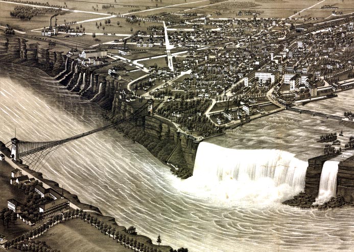
5
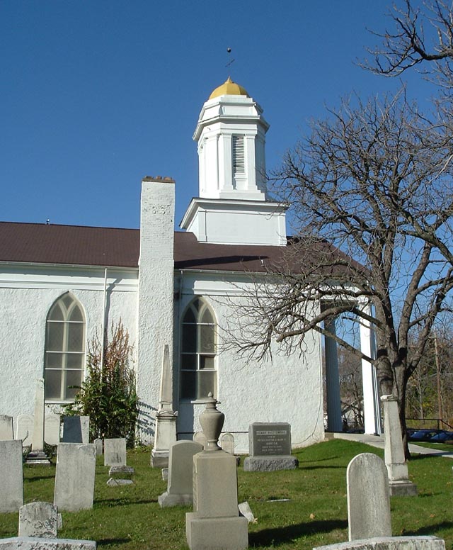
- Michigan St. Baptist Church |
9-
Lewiston Presbyterian Church |
| 2
- Roswell Hill (Eden) |
6
- Ferry at Black Rock |
10
- Thomas Root Home - Pekin |
| 3
- Obadiah Baker House (Orchard Park) |
7
- Douglas's Dive: Buffalo Harbor |
11
- McClew Farm |
| 4
- Matthew Eastman House (Attica) |
8
- Suspension Bridge at Niagara Falls |
12
- Lockport Canal Dock and Warehouse |
There
are
several parts to this lesson. First you will decide on a route
for a Freedom Seeker to take on his/her way to Canada. Then you
will read about a real escape on the Underground
Railroad in Western New York. You will look over some primary
sources (old map, census record, a journal) and see
if the story makes sense. Ready? It's time to do some geography!
TASK
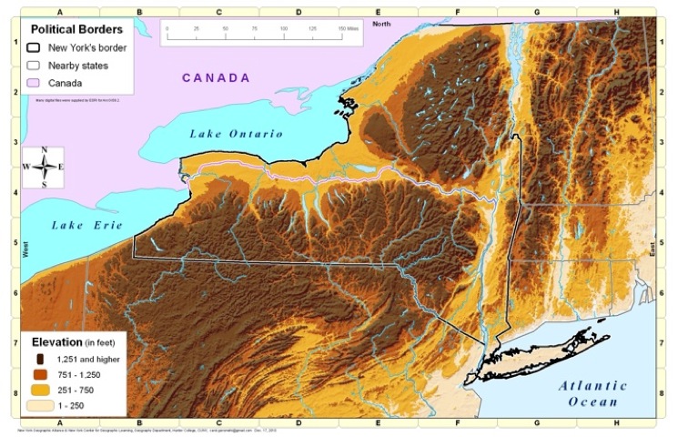
1: Look at the NYGA Elevation Map
(by Carol Gersmehl). What does
the landscape look like
in the Niagara Frontier? Do you think that this would affect the routes
Freedom Seekers took?
TASK 2: Help plan the escape route for a Freedom Seeker:
Eber Pettit ran a very active station in Versailles (#1) on Cattaraugus Creek. A young African-American man showed up at his door one morning, just before the sun came up. He had walked all night and was very tired. Mr. Pettit efficiently took care of this Freedom Seeker. But now it's time to send him off to Canada. The plan is to travel overland to Buffalo and the Michigan St. Baptist Church (#5). Then they would send him across the Niagara River either at Black Rock (#6) or on to Niagara Falls (#8) and Lewiston (#9). Do you like this plan?
Work on the details of this escape plan and record your decisions on the Student Worksheet.
TASK
3: The crossings of the Niagara River are being very closely
watched. You need to find a place to hide the young Freedom Seeker
until the situation calms down. Where could you send him? Write your
plan on the Student Worksheet.
Primary Sources to Help in Verification
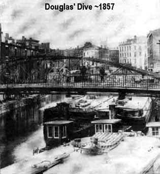
TASK
4: Now that you have determined a possible escape route for a
Freedom Seeker, now it is time to compare it to an actual event in the
real Underground Railroad. To view this document, click on this link: Douglas Dive
Primary Sources to Help in Verification
| Photos of People and UGRR Stations |
Maps and Panoramic Views |
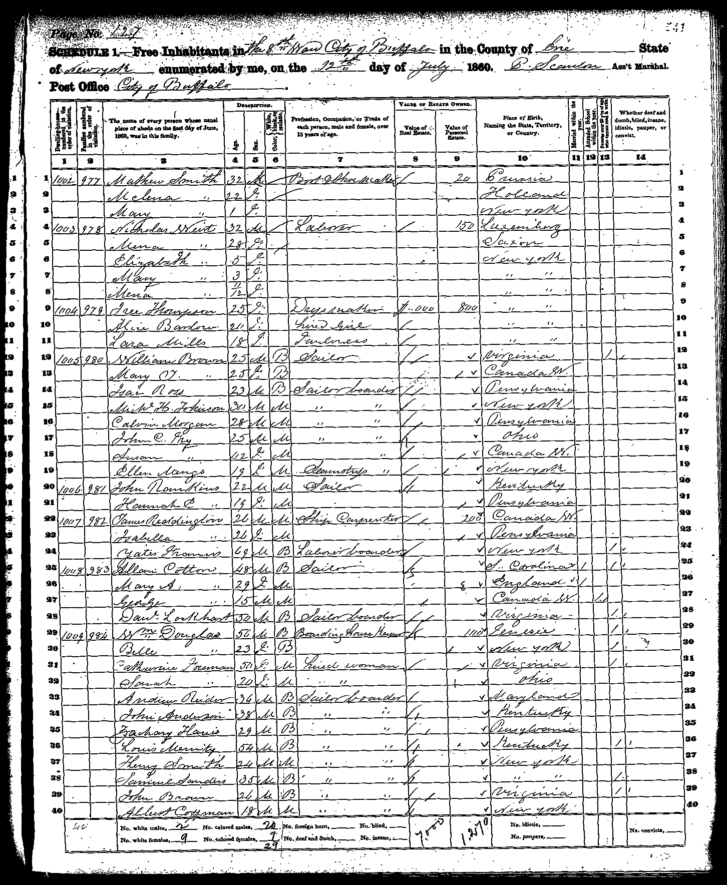
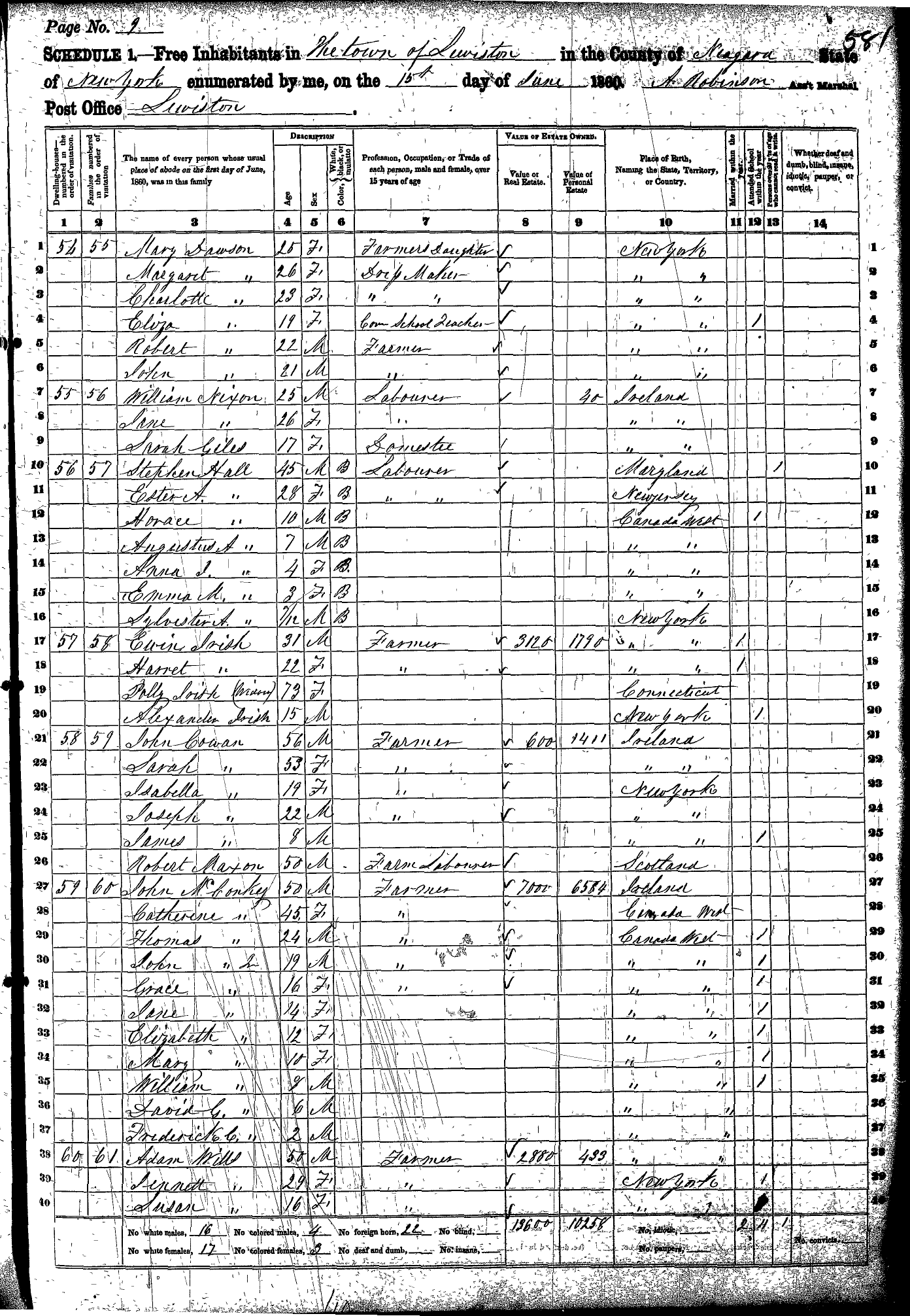
Census Records |
Documents |
| William Wells Brown Douglas Dive Photo Hopkins Creek McClew Farm Barn Lewiston Presbyterian Church Michigan St. Baptist Church Lockport Canal Dock |
NYS Canal Map 1868 Buffalo Harbor Panoramic Map Douglas Dive Map Niagara Falls Panoramic Map |
Douglas Dive Census Record 1860 Eber Petitt Census Record 1860 Lewiston Black Community 1860 |
McClew Farm
in the UGRR Niagara Region Account of Rescue at Buffalo's Inner Harbor |
Make
sure you answer the questions on the Student Worksheet from Task 4.
This includes filling in the chart on the primary sources included in
this web page.
CONCLUSIONS: The wrap-up of this activity will be done as a class. Make sure you participate in the class discussion!
CONCLUSIONS: The wrap-up of this activity will be done as a class. Make sure you participate in the class discussion!
Return to the Underground Railroad Lessons Page
Return to the New York Geography Homepage
Contact Us!