Lessons in the Geography of the
Underground Railroad in New York State
Scenario 3: Northern New Yorkby Timothy McDonnell
New York Geographic Alliance
STATIONS ON THE ADIRONDACK FREEDOM TRAIL

List of UGRR Stations:
| 1
- Leonard Gibbs House (Greenwich
or Union Village) |
6 -
Timbuctoo (John Brown Home - Lake Placid) |
11
- Clifford Laplant House (Champlain) |
| 2
- Old
Stone Library (Fort Ann) |
7 -
Wendell Lansing Farm (Wilmington) |
12
- Major Dimmick Home (Malone) |
| 3
- Old
Fort Edwards Museum |
8 -
Samuel Keese Smith Home (Peru) |
13
- Jacob Parkhurst Home (Ft. Covington) |
| 4
- Canal Port at Whitehall |
9 -
John Townsend Addoms Homestead |
|
| 5
- Darrowsville Wesleyan Methodist Church (Darrowsville) |
10
- Beartown Settlement |
There
are
several parts to this lesson. First you will decide on a route
for a Freedom Seeker to take on his/her way northward. Then you
will read about a real escape on the Underground
Railroad in the Foothills of the Adirondacks. You will look over some primary
sources (old map, census record, a journal) and
see if the story makes sense. Ready? It's time to do some geography!
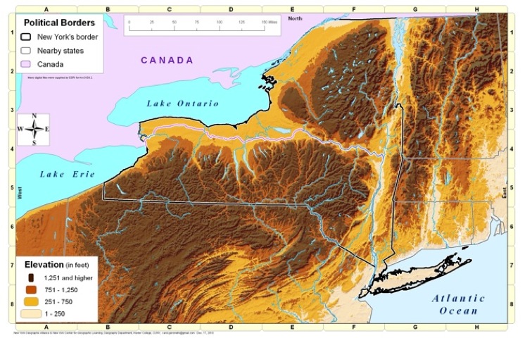
TASK
1: Look at the NYGA Elevation Map
(by Carol Gersmehl). What does
the landscape look like around Lake Champlain and the rest of
Northeastern New York? Do you think that this would affect the routes
Freedom Seekers took?
TASK 2: Help plan the escape route for a Freedom Seeker:
A husband and wife who escaped from slavery several years ago having been living in Troy for several years. Now their former master is in town claiming them. They are taken by wagon to the village of Union (now called Greenwich #1) in Washington County. It is not safe to return to Troy or Albany, so the agents in Union decide to send the couple north toward Lake Champlain and then on to Canada. They probably can slip over the border at the northern end of Lake Champlain.
How do you expect the accomplish this feat? List the stations you will use on the chart on your Student Worksheet.
TASK 3: It looks like the border crossing at Champlain (#11) is too dangerous. What alternative route can you take? Write your new plan on the Student Worksheet.
Primary Sources to Help in Verification
TASK 2: Help plan the escape route for a Freedom Seeker:
A husband and wife who escaped from slavery several years ago having been living in Troy for several years. Now their former master is in town claiming them. They are taken by wagon to the village of Union (now called Greenwich #1) in Washington County. It is not safe to return to Troy or Albany, so the agents in Union decide to send the couple north toward Lake Champlain and then on to Canada. They probably can slip over the border at the northern end of Lake Champlain.
How do you expect the accomplish this feat? List the stations you will use on the chart on your Student Worksheet.
TASK 3: It looks like the border crossing at Champlain (#11) is too dangerous. What alternative route can you take? Write your new plan on the Student Worksheet.
TASK
4: Now that you have determined a possible escape route for a
Freedom Seeker, now it is time to compare it to an actual event in the
real Underground Railroad. To view this document, click on this link: North Country UGRR
Primary Sources to Help in Verification
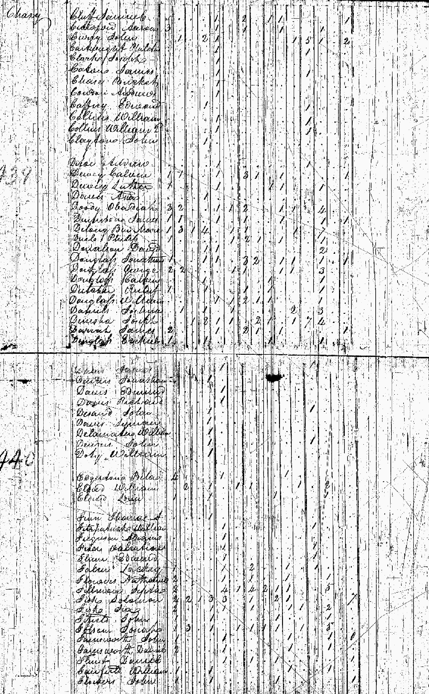
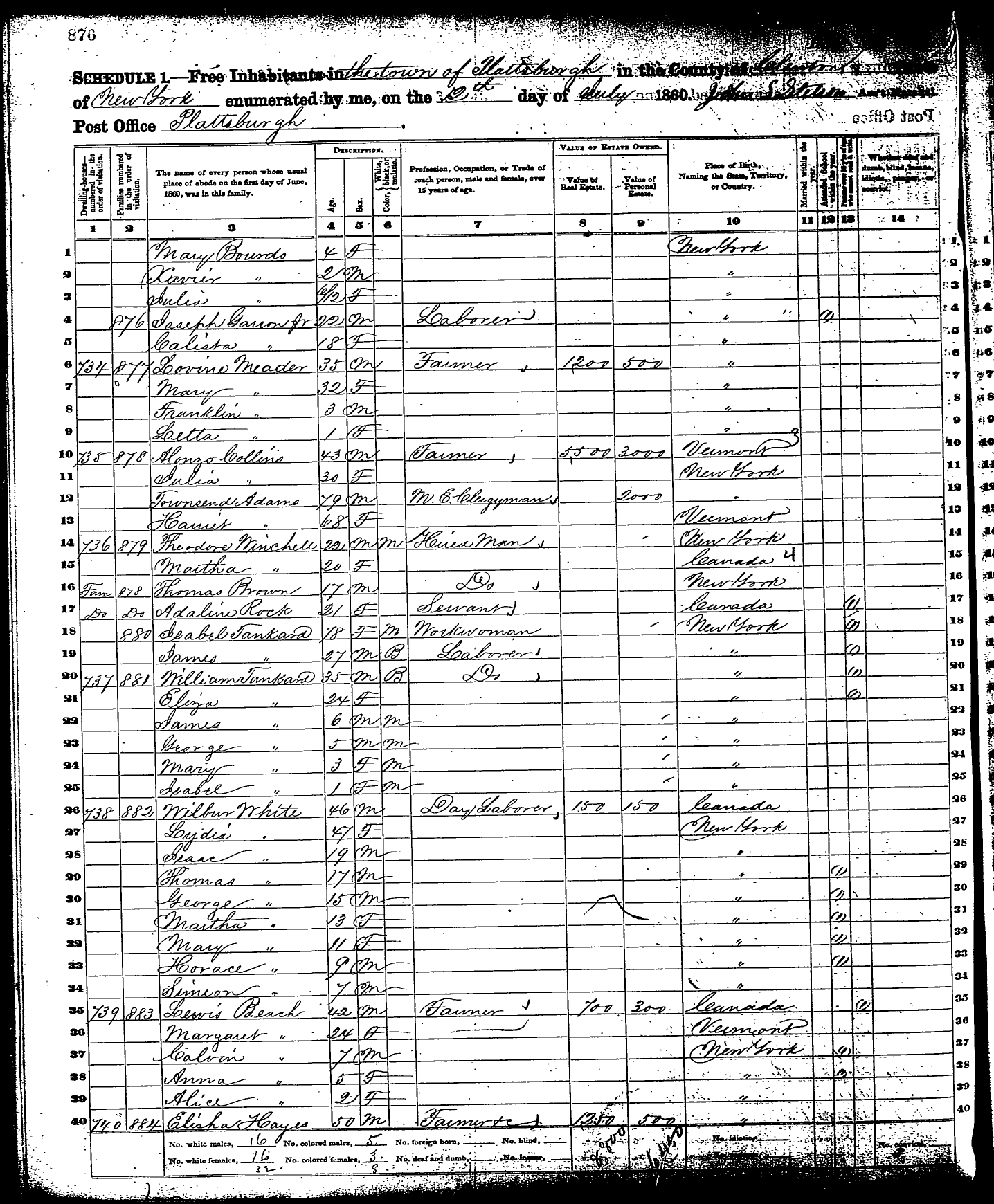
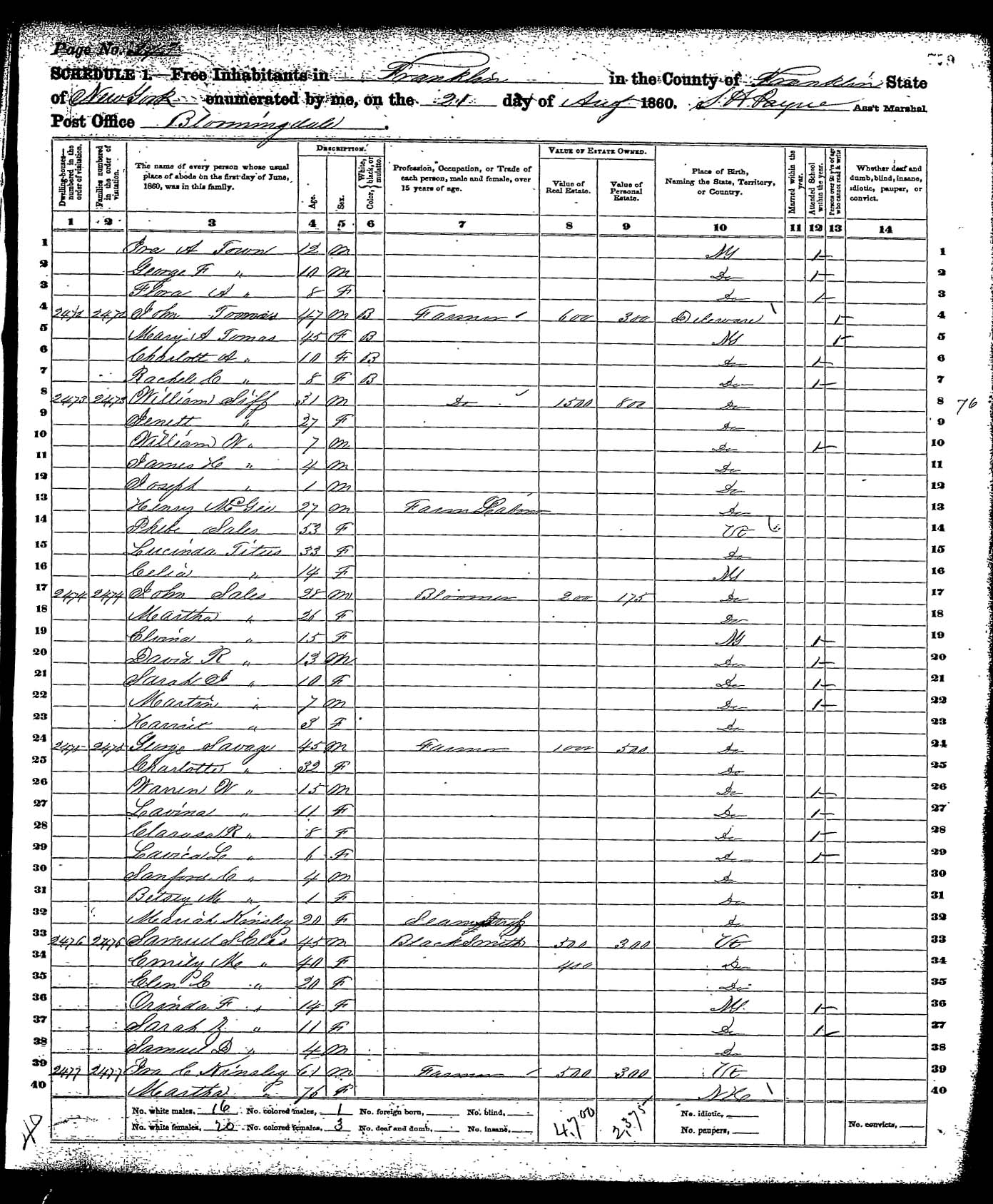
Make
sure you answer the questions on the Student Worksheet from Task 4.
This includes filling in the chart on the primary sources included in
this
web page.
CONCLUSIONS: The wrap-up of this activity will be done as a class. Make sure you participate in the class discussion!
CONCLUSIONS: The wrap-up of this activity will be done as a class. Make sure you participate in the class discussion!
Return to the Underground Railroad Lessons Page
Return to the New York Geography Homepage
Contact Us!